MARGARET HILLENGAS

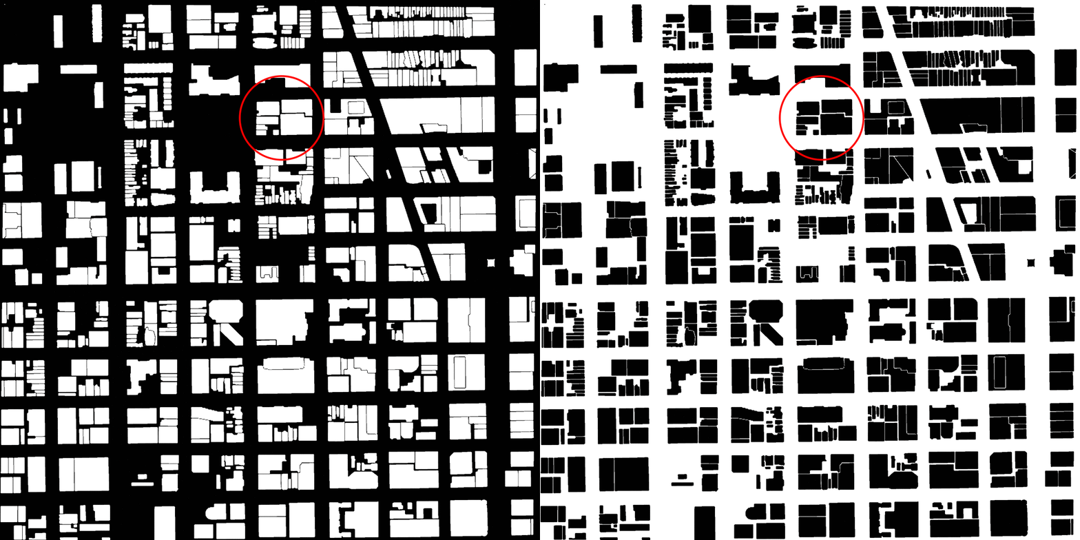
This is a figure-ground drawing of a section of Chicago, Illinois. Just north of the Chicago River, the area is centered around two major arteries, Chicago Avenue and State Street. The eastern half, from State St. to the right, is known for hosting extensive retail at a wide range of price points, attracting both locals and tourists. The western half is mostly residential, a mix of single family housing and apartments.

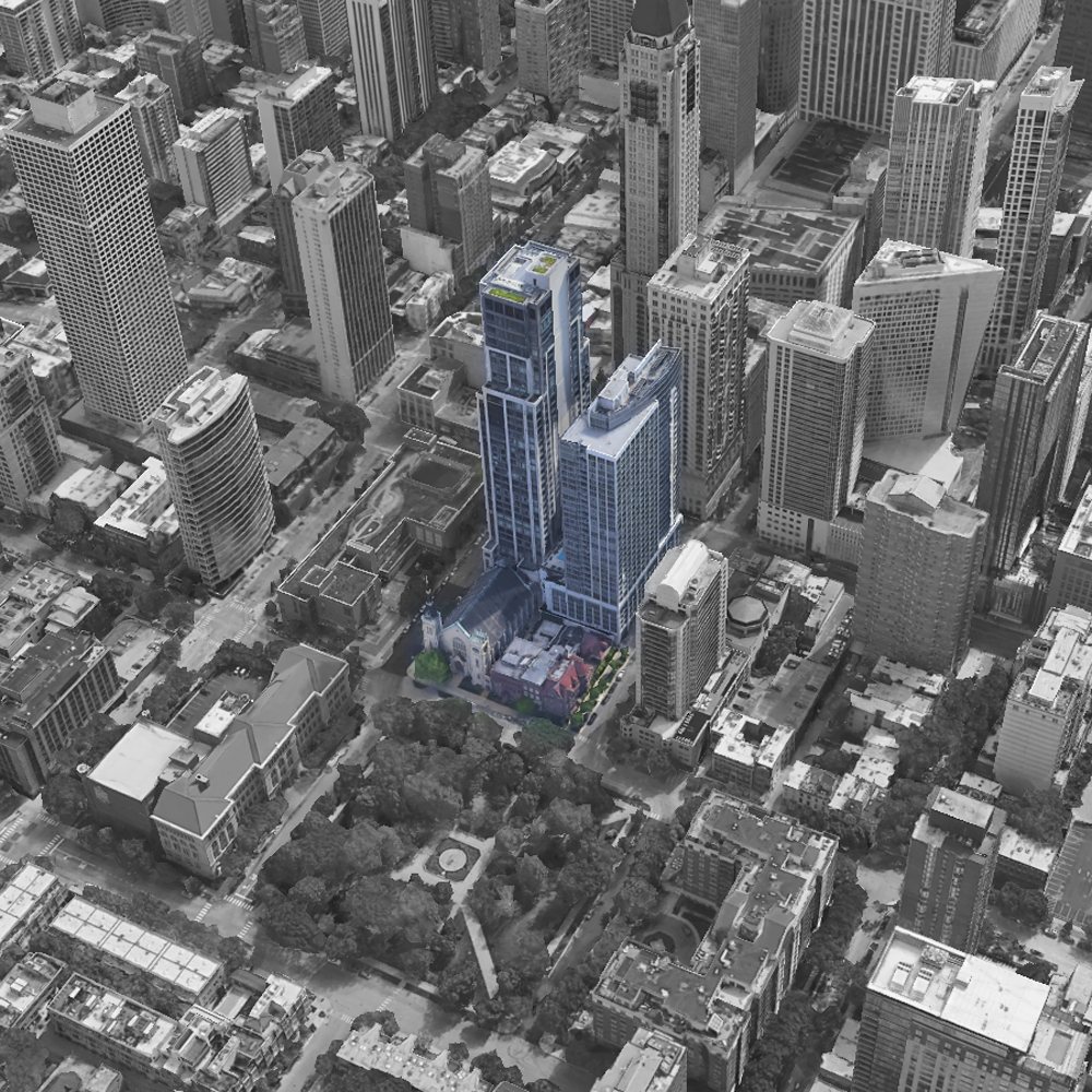
The aerial view illustrates the immense difference in height between the buildings on this single block, which is located on Dearborn St. across from Washington Square Park. There are six lots. The two highrises, both developed by jdl, contain retail on the first few floors followed by luxury apartments. At the leftmost corner is a religious institution, and at the bottom corner is a private, single family residence. In between these two properties are apartments, converted from an old single family residence.

This drawing begins to map the many ways in which the City of Chicago regulates traffic based on zoning. Dearborn transitions from a two way street to a one way street at the left corner of the park, decreasing traffic flow. There is a school zone, which mandates slower driving, a pedestrian crosswalk, and a bike lane, all which work to slow down and thin out vehicular traffic. Parking is available along most of the streets, but notably not available next to the two highrises. A Divvy bike share rack also supports this area as a hub for non-vehicular traffic and tourism.
In this Actor-Network map traffic control is traced and connected to the structures which it supports and which support it. The ways in which a city might choose to control traffic are intertwined with money, class, zoning, access to education and leisure, tourism, homelessness, and environmental impact to name only a few topics. Frequently the segregation of spaces for leisure like shopping districts, restaurants, museums, and parks, along lines of race and socio-economic class is upheld by police. In Chicago, the Police Department is known for being deeply flawed, very well funded, and difficult to push back against.
The inclusion of designated bike lanes and the emergence of bike share programs seems to be a product not only of increased environmental awareness, but also of the debilitating nature of vehicular traffic which can cripple a city’s mobility and make the air unsafe to breathe. Promoting the use of mass transit and biking can decrease the severity of these risks.
The inclusion of designated bike lanes and the emergence of bike share programs seems to be a product not only of increased environmental awareness, but also of the debilitating nature of vehicular traffic which can cripple a city’s mobility and make the air unsafe to breathe. Promoting the use of mass transit and biking can decrease the severity of these risks.

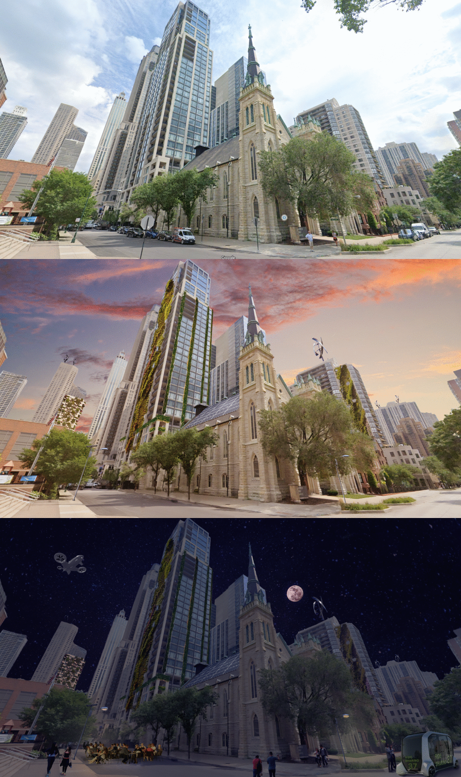
These images portray a reasonably immediate future where autonomous electric vehicles are the primary method of vehicular transportation, reducing traffic, accidents, environmental and noise pollution, and reducing need for signage. A bus-like ride sharing system picks up two people on the corner, and an e-vtol craft transports packages or people from the airport quietly without congesting the city streets. Additionally, large buildings which would be difficult to take down and rebuild have been retrofitted with plant growing exteriors, reducing the energy necessary to heat and cool the building, increasing air quality, and lowering the overall ambient temperature of the city. Solar panels and vertical axis wind turbines have also been retrofitted to buildings and street lights to decrease reliance on the grid and save money in the long term.