LAUREN JENKINS
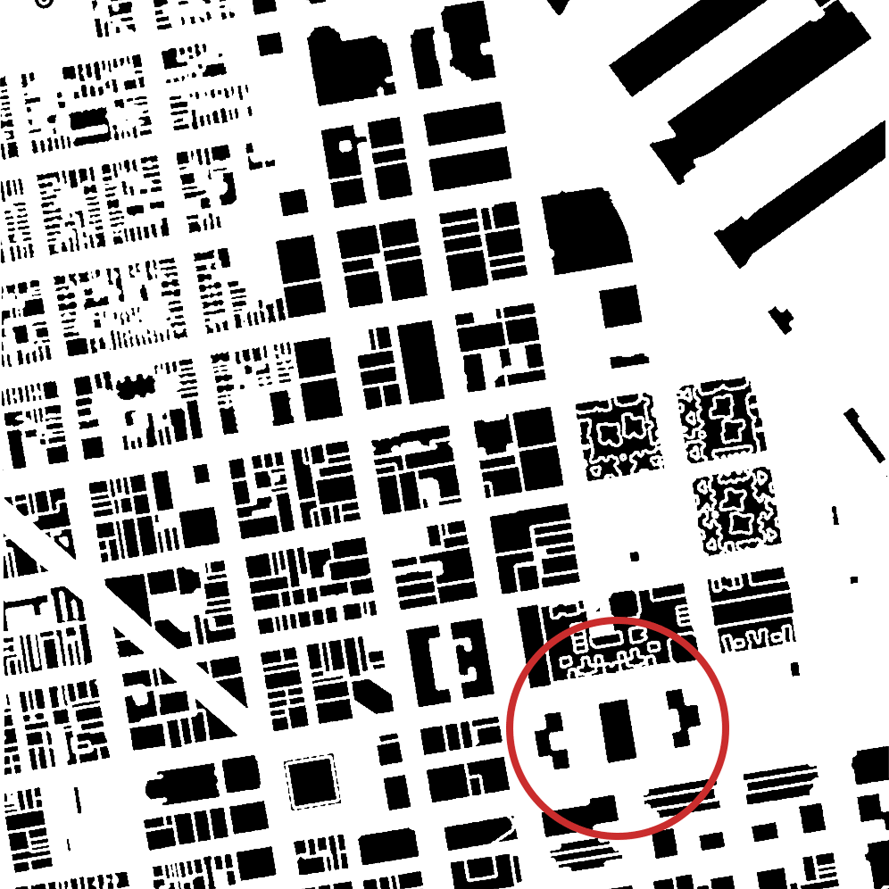
Presented is a figure ground image of San Francisco’s Financial District known for its office skyscrapers, high rise hotels, and hilly landscape. The city accomodates for its growing community with multiple modes of transit, minimal food deserts, terrace gardens, and short access to the San Francisco Bay waterfront.

The aerial view captures a single block nestled in between Clay Street and Washington Street. Both are one way roads that lead in opposite directions. One to the inner city or towards the Embarcadero street running along the waterside. The highlighted buildings sit a top a concrete platfrom which was designed to bring light to the block back in the 1960’s when a freeway ran across the waterfront. Today the buildings are commercial offices, and a commercial showroom. A terrace garden fills the spaces between the three structures atop the single block to provide a sense of peace to the bustling city.
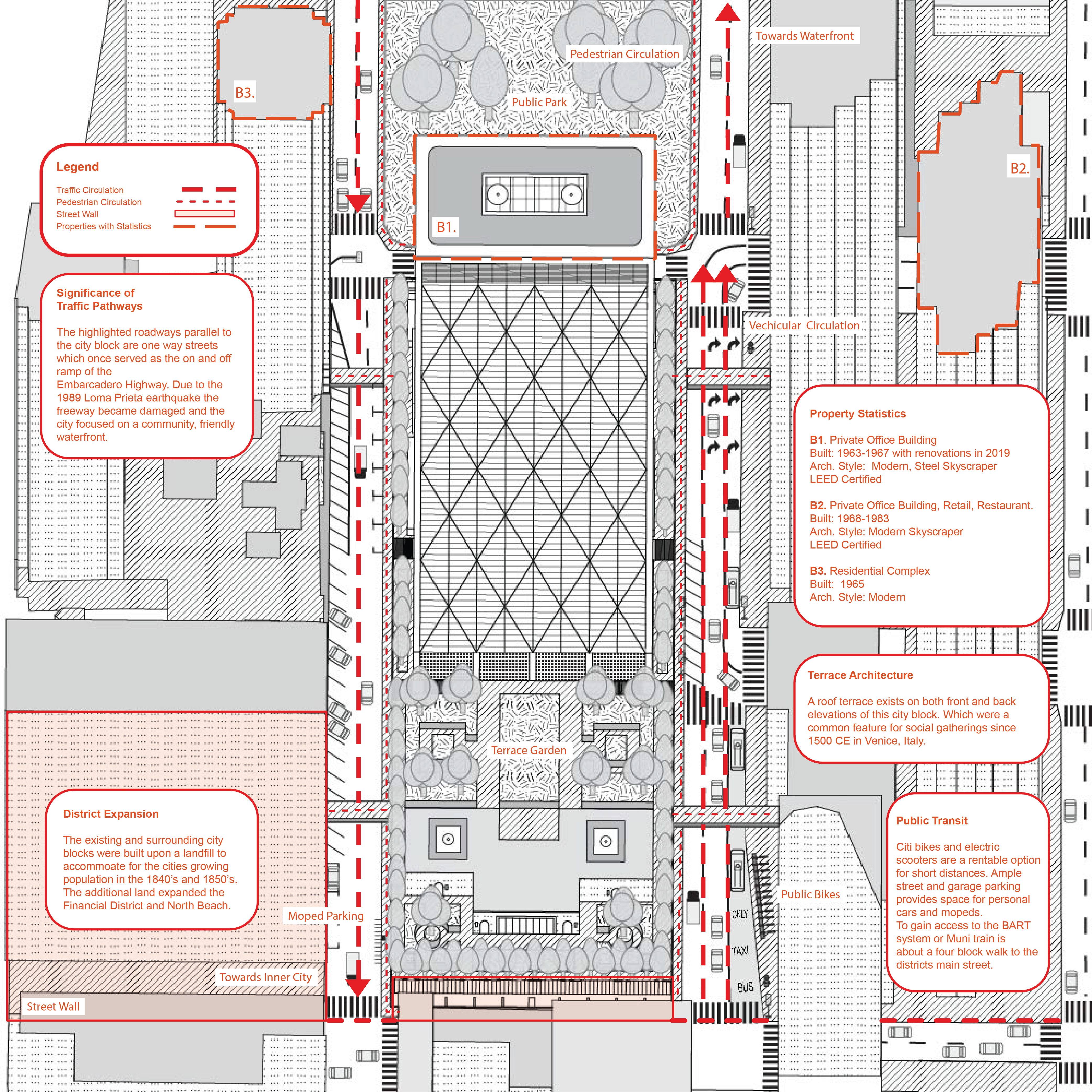
Illustrated is an elevated concrete block surrounded by Clay Street and Washington Street. As a commercial district there are various methods of transit for short distance by bike or scooter or by public train and bus systems. Highlighted in red are multiple paths of vehicular circulation with bold red arrows. A variety of parking is available to this singular block due to commercial offices; which include: street parking, moped parking, and underground parking units. Pedestrian circulation is also highlighted in a small dashed line to show main paths of travel on a road level, and on elevated bridges leading from the main block to adjacent blocks with retail, groceries, and fitness centers.
Created is an ANT Map discussing the history of San Francisco’s Financial District, how the design functions well over the past 50 years, and researching indepth about the urban fabric. This spot is designated to the community of workers, but gives a great range of activities such as groceries, fitness centers, post office, and retail plaza to name a few. All businesses are within a three block span, and also give a variety of transit locations. What also is discussed is Northern California’s natural disasters, such as earthquakes, which lead to a more pedestrian friendly waterfront.
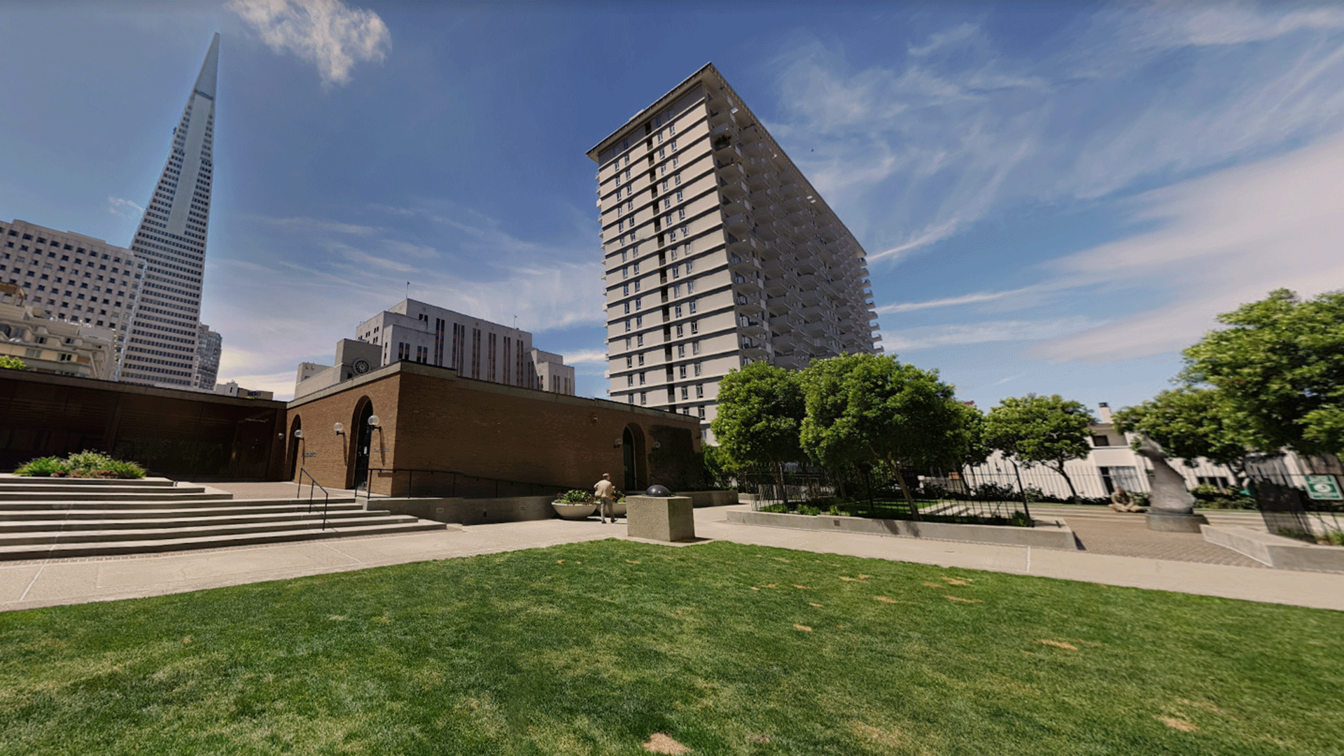
This google snapshot creates a vision of the future for the San Francisco community both in entertainment and limiting food deserts. This space is currently used for tendents of the three different building on this single block. Usually functioning as a break space for those to enjoy the outdoors, walk their dogs, and take personal calls. The idea behind the design is to keep a stress-free zone with live music. The other main goal of this space is to create a community garden that can provide for the current community instead of outsourcing for all food options.