DEANNA BARIS
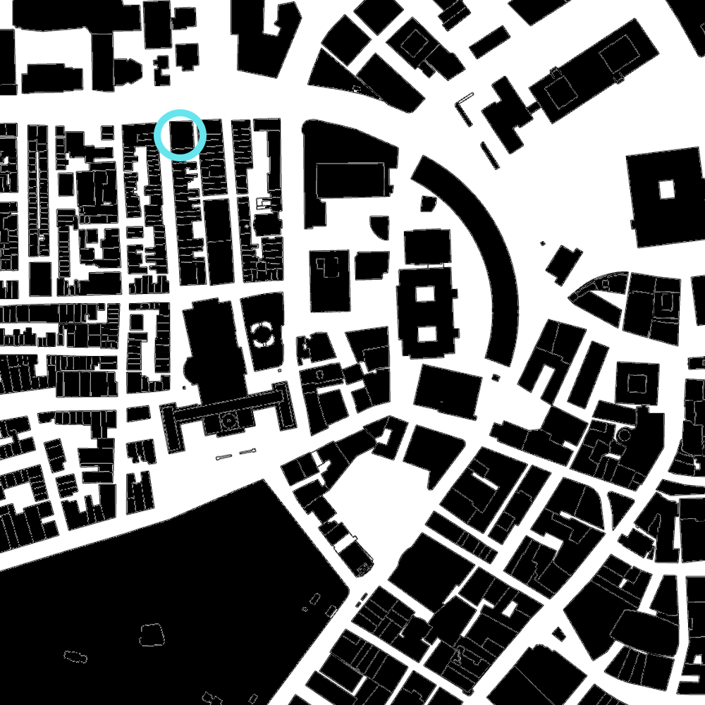
This figure ground diagram shows the intersection of the Beacon Hill, West End, and Downtown neighborhoods in Boston, MA. The area contains a variety of residential and mixed use buildings, with many city government buildings, historical sites, and university properties. The highlighted blue circle is a mixed-use block owned by Suffolk University.

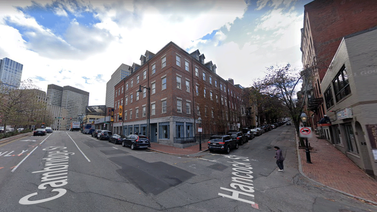
This aerial view depicts a city block on Cambridge Street between Hancock Street and Ridgeway Lane. The highlighted block is a multipurpose property owned by Suffolk University, containing athletic facilities and campus police headquarters. Cambridge Street splits two Boston neighborhoods, segmenting Beacon Hill (on the far side) from the West End.

This drawing highlights details about the Ridgeway Building, Cambridge Street, and the surrounding Beacon Hill and West End neighborhoods. While the immediate circulation is primarily vehicle and pedestrian traffic, the block is located between the Bowdoin and Charles/MGH train stops. Along this section of the road, Cambridge Street is a three-lane one-way road with mixed car and bike traffic. Due to a city parking shortage, there is limited two-hour street parking available. Pedestrian intersections are marked with crosswalks, with trees lining side streets and the central median.
This Actor-Network map follows actors and processes shaping the housing landscape in Boston. The city has a long history of displacement. Some examples include the forced removal of Native Americans westward and to the Harbor Islands, as well as the razing of a working class neighborhood in the West End during the 1950s. Today, the main cause of displacement is the city’s affordable housing crisis amidst wide scale gentrification. With 44 different institutions of higher education in the greater Boston area, students are not exempt from housing challenges. Initiatives to fight displacement exist on various scales, ranging from the federal and state level to neighborhood based community land trusts. Looking towards 2030, the city’s transportation plan includes 69,000 new units across various income levels.
These images reimagine the block as more environmentally sustainable, with improved accessibility and safety for bikers and pedestrians. Four lanes of automobile infrastrucure are restructured into an urban park and protected bike lane. A single lane remains for cars. A meadow with native plants runs between the apartments on Hancock Street, parallel to a bike lane. The Cambridge Street public park includes an urban farm with raised beds, expanding access to affordable, locally grown produce and reducing the need for gasoline-heavy methods of food transportation. As sunset turns to nightfall, solar powered lights improve visibility for bikers and pedestrians. Stars are visible above the city center due to reduced air pollution.